


Produced by the official tourist website visitseoul.net, iTourSeoul has a long way to go. The biggest problem is the lack of useful data sans a Wi-Fi connection, but another problem is odd design.
Imagine coming to tour a foreign country with little more than your iDevice for a travel guide. Sure, Lonely Planet books are around, and there is plenty of other tourist information available - but you want it on your iDevice, darnit! While not perfect, iTourSeoul does offer a decent amount of help - if you can get a WiFi signal.
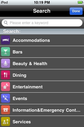
There's a fair number of categories - if you get that far. At first, the application will ask to find your location. It does that to calculate - to the foot or mile - how far away something is. If you tap 'Don't Allow', you'll get a message indicating a Wi-Fi signal is required or else the app will shut down. It feels almost like a 'Choose Your Own Adventure' book - if you decide to allow the app to see your location, turn to page 17; if not, turn to page 13.
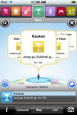
So you finally choose a location. The top row of icons - Shopping, Dining, Bars, Transportation, etc. - help to narrow down the choices. The problem? After selecting the Gangnam station area, I got results for the Jongno and Euljiro area. Sure, it's only 6.1 miles away - but there's no bars in Gangnam?! Come on.
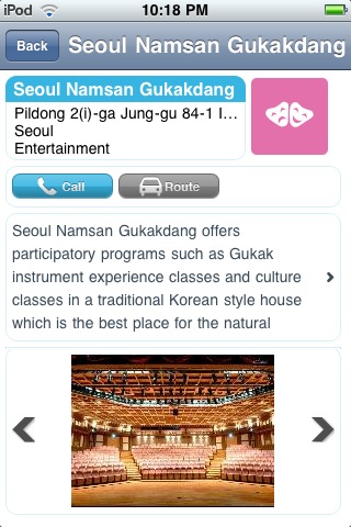
Another result - tap on either panel for a few more words of text or on the arrows for another picture. Get out your magnifying glass - there's no way to zoom in on the picture. Note that 'Call' button - which can't be used on an iPod Touch or iPad anyway - and a route button that only works on an iPhone. That there are no (or very few) directions given means you're left with a street address and a map - not exactly the most encouraging help.
For someone who enjoys downloading apps and using them off-line, this app is NOT recommended to you. That goes even if you've brought your iDevice from your home country - making a call isn't possible as the phone frequencies are far different. The WiFi might work in some places, but it's unlikely to work where you need it (e.g. when actually lost).
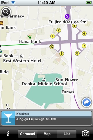
The one useful tool - a map system similar to Google Maps - is in English, shows subway stations, various landmarks, and the places you're looking for. Even on a great Wi-Fi connection (as in being used a few feet from the transmitter), map tiles moved slowly, while multi-touch zoom was quirky. If you have WiFi, you might find the native Maps application to work as well.
While I certainly have nothing against the effort that went into the application, this is a reminder that effort alone does not make a good app.
Since this is the first iDevice app I've reviewed, it's time to create a scale. 1-5 seems to work with my Destination posts, but the categories will be different.
Usefulness / helpfulness: (is it useful / helpful?)

Return on investment: (is it worth the time / money to figure out?)

Intuitiveness / Ease of use (can you pick it up and use it, or do you have to tinker with it?)

Looks / Design (while not every app is elegant, do you want to stare at it for an hour?)

Overall: (keep it or delete it?)
iTourSeoul is available on the iTunes store as a free download.
 © Chris Backe - 2010
This post was originally published on my blog, Chris in South Korea. If you are reading this on another website and there is no linkback or credit given, you are reading an UNAUTHORIZED FEED.


 RSS Feed
Recent comments